
 View on Asset Store (opens in new tab)
Package details
- Latest version
- 1.0
- Last updated
- First released
- Unity version
- 5.3.4 or later
- Package size
- 404 KB
- Files
- 12
- Favorites
- 8
- Views in the past week
- 2
Price tracking
- Last checked
- Tracked since
- Lowest recorded
- $5.00 on
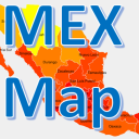
Mexico map with states
Price $5.00
Buy on Asset Store (opens in new tab)
Affiliate link · Purchases support this site
Price history
Last 6 months
USDAsset preview
1 / 6

Mexico map with states screenshot 1


About this asset
Click/touch detection on states irregular areas
Click/touch each state to trigger aa method, it detects with precision the area of the clicked state.
Also, click in the thin space between states, and it triggers the detection of the closest state.
This asset includes a method to show the name of the selected state and area in km.
Color states independently
It presents each state in the color you define, Includes examples of single color and a heat map going gradually from red to yellow. Useful in business intelligence charts also.
Zoom, scroll.
Includes buttons to zoom in/out, also listens to pinch gesture.
When the map is larger than the screen it can be scrolled with mouse or swipe gesture.
State names.
Shows state names as floating text.
Names don't overlap on small areas, they are configured in a resource file to be shown at a certain level of zoom.
Lightweight.
Area detection does not uses images, just a 100kb text resource file.
To show the map only one sprite is used.
Fully customizable C# code.
A prefab, a sprite, text data files and a C# script is all it takes, so you can modify at your needs.
More info.
http://davidhf.name/AssetsForUnity/MEX_Map_Documentation.htm
Click/touch each state to trigger aa method, it detects with precision the area of the clicked state.
Also, click in the thin space between states, and it triggers the detection of the closest state.
This asset includes a method to show the name of the selected state and area in km.
Color states independently
It presents each state in the color you define, Includes examples of single color and a heat map going gradually from red to yellow. Useful in business intelligence charts also.
Zoom, scroll.
Includes buttons to zoom in/out, also listens to pinch gesture.
When the map is larger than the screen it can be scrolled with mouse or swipe gesture.
State names.
Shows state names as floating text.
Names don't overlap on small areas, they are configured in a resource file to be shown at a certain level of zoom.
Lightweight.
Area detection does not uses images, just a 100kb text resource file.
To show the map only one sprite is used.
Fully customizable C# code.
A prefab, a sprite, text data files and a C# script is all it takes, so you can modify at your needs.
More info.
http://davidhf.name/AssetsForUnity/MEX_Map_Documentation.htm
From the publisher's Asset Store listing.